This is not a new document, but is one I wrote in 2007 after qualifying for a 800km unicycle race in Nova Scotia. After a hard drive crash in 2009 I thought this had been lost forever. I have recently managed to recover a load of files from this drive, including my write up as a Word document. I’ve decided to publish it here to share with you lovely internet people and hopefully reduce the likelihoods of loosing it again.
Ride The Lobster Qualifying Ride
Nottingham To London Via Unicycle
September 10th & 11th 2007

The facts;
Unicycle
Schlumpf 29″ Geared unicycle (effective wheel size 43.5″ in high gear, 29″ in low)
Tyre: Big Apple 2.0″ road tyre
Cranks: Schlumpf 150mm
Seat: UDC Gel Saddle
Handle: T7 (no accessories)
Day 1
Monday 10th September 2007
Start time: 7.45
Finish time: 18.15
Distance 73.49 miles (118km)
Ascent 511ft
Decent 508 ft
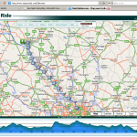
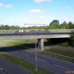
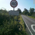
Route: Nottingham toNorthamptonvia Long Eaton, Kegworth, Loughborough, Leicester, Kelmarsh, Market Harborough
Link http://www.mapmyride.com/ride/united-kingdom/nottingham/133565982
Day 2
Tuesday 11th September 2007
Start time: 8.00
Finish time: 18.15
Distance 70.58 miles (113km)
Ascent 520 ft
Decent 620 ft
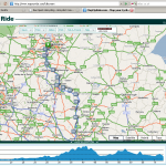
Route:Northamptonto Wood Green,Londonvia Milton Keynes, Dunstable,St Albans, Potters Bar, Cockfosters
http://www.mapmyride.com/ride/united-kingdom/nottingham/132800233
The Preamble
In June 2008, the biggest unicycle race ever staged will happen in Nova Scotia. This race, Ride The Lobster (www.ridethelobster.com) covers the 800km length of Nova Scotia in 5 days. Four of these being Tour De France style racing, and one day of time trials. It will feature the best distance unicyclist riders in the world, but is open to anyone that can qualify, get a team together and get over toNova Scotia. There is a $10,000 prize fund for the winning teams.
When I first heard about this, I thought, WOW, I would love to be there. At the time my biggest unicycle was 29″, and after a 4 hour ride, I had damaged the cartilage in my right knee. If I had any hope of getting there, I would have a lot of work to do. The qualifying ride is a great way to sort out those that can manage to complete the race from those that just want to take part, and has a minimum distance that has to be ridden over 2 days, although this distance takes in to account terrain, weather and daylight conditions. The rules state “Two consecutive days with the first day rating 125 and the second day rating 150 (see the rating calculator below). This roughly works out to be 75 km with 500 m of elevation gained for both days. Or, with little or no elevation it is 87 km the first day and 90 km the second day.”
Back in April 2007 I rode fromSwanseatoBirmingham(136 miles) over 4 days, one of which was a rest day. That was on a Nimbus 36 over some fairly mountainous terrain, and my legs suffered badly. Apart from the date being too early to qualify, the distances on the first and second day would have barely scraped through and the second was no where near enough. Since then, however, I have bought a Schlumpf geared 29″ unicycle. This has the advantage that riding slowly in heavy traffic conditions or climbing steep hills, in low gear it works much better than a 36″ wheel. The rest of the time, however, in high gear, it has the effective wheelsize of a 43.5″ wheel, so can be even faster than a 36″. With this in mind, I thought I would be ready to take on the challenge of riding from Nottingham toLondon.
When driving on the motorway, this is around a 130 mile trip, and can be completed in just over 2 hours with good traffic (I’ve also done it in 18.5 hours in a snow storm though!). Of course, the motorways are out of bounds to a unicycle, but there are a lot of nicer roads to ride down, some of which are more direct than via motorway. Looking on the map, and using TomTom sat nav to estimate the ‘bicycle route’, it seemed like Northamptonwas a fairly central point. So, a few days before hand, I booked a hotel in Northampton. And that was it. No going back.
Like the majority of my rides, I did it solo. To be honest, I prefer to ride this way as I don’t feel guilty for slowing someone else down, and I don’t get frustrated when someone slows me down. That, and the fact that there’s not many unicyclists that would want to ride from Nottingham to London!
One thing that I learned from the Swansea to B’ham ride was that I needed to travel light. I packed the minimum amount of clothing for an overnight stay and a second day on the road. This still made my back pack fairly heavy, but a lot lighter than I often have for the 8 mile ride to work. Most of the weight, however, was taken up by the full Camel Back.
I had done part of the route before, and knew that some of that wasn’t a good idea, so part of the route toLeicester was new. I knew that the National Cycle Route would take me pretty much all the way through toMilton Keynes, so I spent the whole weekend before I set off trying to get hold of a map. These maps, however, are like fairy wings – some people don’t believe they exits, others have no idea what you’re talking about, and others claim to have seen them, but no longer have any in stock. So I set off with only a partial route, and planned to make things up as I went along.
The Maps


The story
Day 1
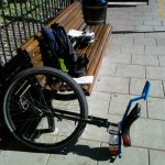
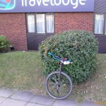
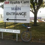
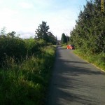
After faffing around getting everything packed and ready to go, I was out of the house by 7.45. Quite a bit later than the 7.00-7.30 start I’d planned, but not too far off. Time for a quick photo, trying to get both the unicycle and watch in the shot, and I was off. This was to be a solo ride, getting down to a hotel inNorthamptonthe first night, and on toLondonthe following day. The forecast was for dry weather, with a bit of cloud, although as I set off the first thing that hit me was the wind. As the route away from my house is uphill and the wind was coming towards me, I began to realise what a stupid idea this was. Barely half a mile later, and I’m out of breath already. That’s not a good sign. Thoughts start to go through my head about why I’m doing this, can I make it, did I remember to pack everything. Well, if I’ve forgotten to pack anything now, it’s too late, I’ll just have to buy it on route. As long as I’ve got money with me, I can get by. Hmmm… I don’t remember packing my wallet. Stop, check backpack… no. No wallet. Bugger! At least I’m only about a mile from home, so off I go back to get it.
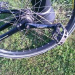
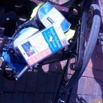
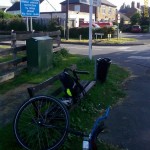
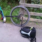
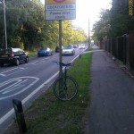
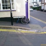
8.00 and time to start off. Again. At least this time I’m ready for the windy hill ride! The first bit up through Stapleford is nice road riding. Normally it’s not too busy, although due to my late start, I’m now in the middle of the school run time that I’d hoped to avoid. Just the other side of Stapleford I turn off down the canal tow path. Apart from a few zig-zag type fences designed to hinder wheelchairs, pushchairs and unicyclists, it’s a very nice ride and one I’ve done several times. Today, however, it feels not quite right. Slightly squishy, with more drag than usual. As I get out the other end, I stop and check the tyre. Fairly soft. Bugger! I figure it’s worth taking a photo as I pump it up, as I have a feeling this might be a reoccurring theme for the next 2 days (Luckily it wasn’t – I just hadn’t checked it before I left). As I ride through Long Eaton, I’m still the centre of attraction for the school run.
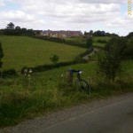
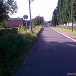
I should point out that my intended route was to follow National Cycle Route 6 (NCR6) all the way toMilton Keynes. However, despite trying loads of local bike shops, book stores, tourist information and hiking shops, as well as looking everywhere on line, I couldn’t actually get hold of a map. I had, however, worked out a route at least as far asLeicester, and expected to have picked up the signs by then. So, as I came out of Long Eaton, I knew I needed to head South down to Loughborough, but I came to a crossroads where NCR6 was marked East/West. No destinations. Just there bisecting my planned route. Should I follow the signs? If so, left or right? No, stick to the plan, and go strait on. Not long later I get to Kegworth, and it’s time for my first break (not including the wallet collection or tyre pumping stops!) From here it’s a nice ride along side the A6 on a cycle path to Loughborough, by which time I’d found some NCR6 signs that were pointing in my direction. It’s pretty much a strait through route at Loughborough, and then follow a shorter, more scenic road down toLeicestervia Quorn and Roathley.
Once I got toLeicester, I figured it would be a good idea to head to the local Tourist Information office to see if I could pick up the map I needed. The lady there didn’t know anything about any National Cycle Routes, but pointed out that the bike shop almost opposite is very good. And she was right. They were good, and had exactly the map I needed to complete the journey toMilton Keynes. All I had to do was get my barings, find my way out of the city, and start following the NCR signs again. All of which proved more difficult than I had expected. After realising that I was riding along the A6 again, and hadn’t seen a sign in a while, I decided to use Sat Nav to get me back to the nearest village where I once again picked up the signs. The route took me down very quiet country lanes with some nice scenery along the way. I was getting hungry and decided to stop at the next pub I saw for a spot of lunch. Each village, however, was either smaller than I had expected, or they kept their pubs a well hidden secret. I’d almost reached breaking point (and Market Harborough) before I came across The Old Kings Head. Luckilly for me, at 14.10, they were still serving food. So, a pint, and a scampi and chips later I was back on the road again.
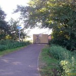
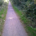
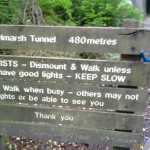
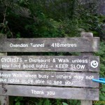
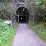
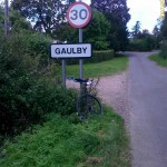
Having got slightly lost coming in to Market Harborough, and having a row with a van driver that insisted on driving right over the cycle path (And he has the nerve to tell me I should get off the road!), I made it to the start of the Brompton Valley Way. This was what I’d been looking forward to all day long. a 14 mile cycle path that goes strait toNorthampton. It follows what used to be a railway line, so it’s almost totally strait and flat, and the surface is a fine light gravel that is a dream to ride down. It’s intersected a couple of times by roads, but other than that it just goes on and on. It also has what was the highlight of my day… 2 tunnels! The first is 418 meters long and the second is 480. They are cold, damp, and totally dark. The exit is just a pin prick of light at the other end, and even with a decent head torch on, the sense of disorientation is overwhelming. The first one has a constant leak in the roof, so even though it was hot and sunny outside, there was the sound of dripping on to a wet slimy floor. After a few skiddy incidents, I finally UPDd at around the 2/3rds mark, got back on and then completed it. Wow! That was great. A mile or two later and I get to the second, longer tunnel. This one isn’t so wet, so even though the terrain is quite rough, and the pin prick of light even smaller, I manage to make it all the way through without a dismount in 2m59s. Just fast enough to keep the momentum going, but not too fast to scrape a wall hard either. Just past the half way mark a bloke walking the other way just appeared about 5 meters in front of me. He’d have seen the head torch I had, but I really had no idea he was there until he was so close!
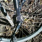
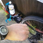
Ok, that was the highlight, now, time to crack on and get toNorthampton. But first, I notice that my Camel Back has run dry, so I wonder how much further I’ve got to go before I can refil. A few miles later and I’m starting to feel quite thirsty. A couple of miles more and we cross a road. I check the map, and notice that I’m only a couple of miles away from a large village, and that there doesn’t look like any kind of refueling stop on route for quite some time. Ok, it’s worth the detour as I really need a drink now. I look down at the cranks to check if I changed down to low gear before dismounting, and notice that gold shift button has gone. Bugger! I wasn’t expecting to lose that! I look around where I’ve stopped and there’s no sign of it. The last time I changed up to high gear must have been a good 5 miles ago, and it could be anywhere between here and there. Thank god I bought a spare! So, back to the important things, a detour up a very steep hill where I found a shop that I could buy cold water from. Lovely!
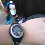
I not very good at freemounting the Schlumpf in high gear, but with the shift button gone, it’s either that or else ride the last few miles in low gear. Ok, high gear freemount it is then! Luckily these all go much better than expected, and it’s not long before I finish the cycle path, and and up on some pretty major dual carriageways to get to the hotel. Ah, that looks like it… Only 10 hours 30 mins, after leaving Nottingham and I have got toNorthampton. And, that’s the end of day 1
Day 2
Day 2 starts with me being less prepared for the day than I expected. I really didn’t have a lot of luggage with me, but it seemed to take ages to get packed. I use the spare gear shift button that I had with me to repair the Schlumpf. This has a 1.5mm hex socket grub screw. Luckily I bought the 1.5mm hex ‘bit’, but, sadly, no bit driver. Doesn’t matter, does it? Finger tight should do. So, 8am, and I’m ready to set off. First of all, back in towardsNorthampton, where I managed to find the badly signed NCR6 again. All this time I’d been in low gear, but now I’ve got out to a park, I kick it up in to high gear, and get going for half a mile or so before I have to dismount for a road. A quick look down, and, yes, you’ve guessed it… button gong! Bugger! It really can’t be that far away, so I start walking back the way I’d come untilI find it lying on the ground. I decide to fit it, and do it up finger tight again, but daren’t think about using it in high gear as that’s obviously what it doesn’t like. All I have to do is find someone with a bit-driver so I can tighten it up properly. Hmmmm….
The map was invaluable in getting me through the city, however, on the other side, it goes through a park and over a bridge crossing a river. The bridge, however, is boarded up, and made totally impassable. Looking at the map, and where other paths go, I think I can find a route around. Northampton is one of those places with lots of cycle routes. For people that live there and know where they are going, this must be great. For me, however, it gave me too many options, and before I know it, I’m in the middle of an industrial estate. I ask in a couple of warehouses if the have a spanner I can borrow for 2 mins to tighten the allen key, but the Polish work force suddenly don’t seem to understand what I’m on about. Oh well, carry on and try to find out where I am. Eventually I pick up a sign for a cycle route toMilton Keynes, so I head that way. Not long later, I spot some landscape gardeners having a tea break by the side of their van. These kind gents were good enough to lend me a spanner to get the tiny grub screw nice and tight. I’m at least an hour behind schedule, but I now have a fast unicycle again and I know where I’m going. Time to get on with it.
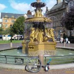
Not long later, though, I spot a sign for a country park cafe, and decide it’s actually time for breakfast! Then, back down the back roads towardsMilton Keynes. Despite the map being brand new, it shows ‘proposed cycle routes due to open in 2002’. One of these cuts out a bit of the road, so I try to track it down. It’s pretty much where it was proposed, and I had a fantastic run down by the side of the railway line. This was all slightly downhill, and I was loving the speed! Things got a bit confusing when it rejoined the original route, but I’m sure I followed things correctly there. Then I decided to detour again. The NCR6 route takes you around 3 sides of a square, but there is another route marked on the map that just takes you down the one side. Sounds easy, right? Well, there are loads of cycle paths here, and they don’t follow any roads, they don’t follow any logic, and they have signs for places that aren’t on my map. The amount of time I had to stop and check the map, and go back, and check again, and, oh, that might have been right after all…. was adding up. The part where I rode down a road, UNDER a canal, then spiraled up to a bridge, and crossed the road at the same level as the canal was pretty cool though. However, by the time I had made my way passed the Roman villa, the Concrete Cows and The Bowl, I was running very very late indeed.
From here the cycle routes went toOxford, and I didn’t want to go that way. The A5 goes directly towardsLondon, but that’s quite a major dual carriageway, which, as it turns out, has very few bits of cycle path. However, I’ve done around 25 miles, and got almost 50 to go, and it’s 1.30pm. I really need to hurry up, and not get lost. So, I head on down the A5. This is not a fun road to ride down, but at least here I managed to spot the highest amount of identifiable types of roadkill!. I spot a sign saying I’m 8 miles from Dunstable, so think this is worth racing for. It’s a bit hilly (both up and down), but 40 minutes later I’m there. Not a bad speed considering that I’m hardly riding on fresh legs! Talking of Fresh Legs, I’ve been wearing padded Lycra cycling shorts, with some baggy non-padded cycling shorts over the top (partly for modesty, but mainly for pockets). However, after well over 100 miles, I’m really beginning to feel some discomfort down below. After I’ve stopped for a quick break in Dunstable, and refilled the Camel Back, I head off again. Where the A5 joins up with the M1 there are major roadworks, but I skip strait through these and follow the road out towardsSt Albans. By now the ‘shorts’ issue is getting too much, and I have to remove the outer baggy shorts. Not ideal pocket-wise, and my small backpack can barely take any more, but it MUST be done.
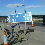
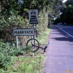
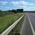
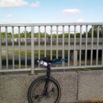
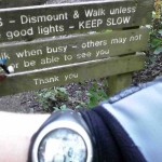
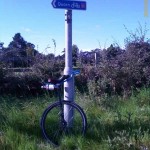
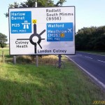
I’m using TomTom sat nav to guide me now, and it’s picking out main-ish roads that take me strait throughSt Albans, over the M25, and strait in to a Road Closed sign. From here traffic can either go back where I’ve come from, or round the motorway. Tell you what… I’ll ignore the sign, and see how far I get… Well, a couple of miles later, and I find the junction they are resurfacing. The pavement is not touched, so I can easily walk past, hop back on, and carry on my way. The gamble paid off! Under the A1M I go, then through Potters Bar, and back over the M25 again heading in to Cockfosters. This sign is Worth a photo, as the Steve Hogan advert always made me laugh (Japanese tourist on the underground: Scoose me, can you show me way to Cockfosters? SH: Sure mate, drink it warm!). From here I could actually jump on a tube to my final destination. It’s gone 6.30pm, but I want to get closer to the center ofLondon.
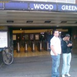
Half an hour later, I cross the A406 (North Circular Road), so I’m within Londonfor real. There’s an underground station in front of me, so time to call it a day at Wood Green. The final distance came out to just over 70 miles for this day in 11h15m. Ironically, I would have had to cycle another 20 minutes to my girlfriends house (final destination), but instead spend about 40 minutes standing up on packed trains, changing twice, and riding an extra mile at the other end. But by this stage, I’d gone past the point of caring. 144 miles over 2 days, and I’d set myself many new targets to aim for next time!
Post amble
Whilst 144 miles in 2 days on a unicycle is pretty impressive to most people, and far exceeded my personal best so far, I felt like I could have done better. The following day I was aching quite a bit in the legs and back, and had to go ‘commando’ for a day or so because of the saddle sore. However, it didn’t feel that it had pushed me quite as much as I could take.
This was ok though. The goal had been to get a qualifying run on the board, so I had tried to avoid burn-out after day 1. I was also quite aware that the route planning and navigation left a lot to be desired. In total, several hours and many miles were wasted to this. Stopping to take photographs here and there also added to the time (although often gave much needed rests). Failing to fit the break to the uni also added time to the journey, and added extra strain down some of the steeper hills.
The new goal now is to repeat the same journey in a significantly reduced time (say, 7 hours per day), and then do a similar journey, but to the closest London Underground Station in a single day. Watch this space for more news…
The Photos